
A complete and accurate stormwater map is one of the most important responsibilities for any community that operates as a Municipal Separate Storm Sewer System, or MS4. These maps are not created merely to satisfy a regulatory checkbox. They protect waterways, support field crews, reduce liability, and give municipalities the information they need to plan maintenance, repairs, and long term upgrades. Understanding exactly what must be mapped, and why it matters, helps communities build a system that truly works rather than one that only exists on paper.
An MS4 map must begin with all stormwater conveyances. This includes pipes of every diameter, whether they are corrugated metal, concrete, PVC, or vitrified clay. These pipes represent the skeleton of the entire drainage system, and mapping them allows crews to understand how water moves through the community. Without this information, towns cannot trace sources of pollution, identify bottlenecks, or determine what assets may be overwhelmed during heavy storms. Pipes also help crews understand where illicit connections could exist because any unmapped feature can become a blind spot for enforcement and compliance.
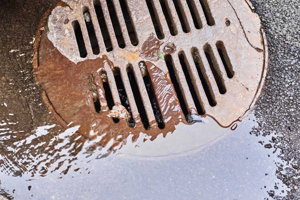
Catch basins and inlets are another required element. They are the primary entry points for stormwater runoff, and they also serve as collection points for sediment, trash, and pollutants. Mapping these structures helps towns schedule cleanings before they fill, which can prevent localized flooding and improve water quality. In many communities, catch basins collect a surprising amount of road debris, which can be washed straight into local waterways if these locations are not routinely inspected and maintained. When mapped properly, crews can also identify problem areas where specific basins clog repeatedly and may need redesign.
Manholes must also be included. These structures provide access to buried pipes and junctions, and they allow crews to inspect and maintain the system from inside. Mapping manholes helps communities understand the layout of underground infrastructure. It also provides reference points during emergencies when crews need to pinpoint a location quickly. Manholes are especially important when documenting system connectivity, since they often sit at transitions between different pipe sizes or materials, and they help explain the overall flow of stormwater.
Culverts are another essential feature. They allow water to pass beneath roads, driveways, and rail lines, and they are often the backbone of rural or low density MS4 areas. Mapping culverts ensures that they are sized correctly, monitored for erosion, and evaluated after storms. These structures can cause severe problems when they are undersized or obstructed, and a complete inventory helps towns prioritize replacements and prevent road washouts.
Outfalls are among the most critical components that must be mapped because they represent the point where stormwater leaves the MS4 and enters a natural waterway. Regulators require detailed mapping for each outfall so that towns can track the final destination of their stormwater. This information helps with illicit discharge detection, water sampling, and compliance reporting. When an outfall is not mapped, it becomes nearly impossible to determine whether the system is functioning properly or whether pollutants are being released into sensitive habitats.
Open channels and ditches should also be included. In many communities, these segments carry stormwater just as formally as pipes do, even though they are above ground. Mapping them helps towns identify erosion issues, sediment buildup, and any potential for bank failure. These areas are often overlooked, but they can be among the most vulnerable parts of a stormwater system because they interact directly with the landscape.
Some communities also map stormwater control measures such as swales, rain gardens, detention ponds, infiltration basins, and constructed wetlands. While specific requirements vary, mapping these features provides a clear picture of where treatment occurs and how stormwater is being managed before it reaches downstream waters. It also supports regular inspections and helps municipalities demonstrate progress toward meeting water quality goals.
The reasons behind all of this mapping tie directly to the purpose of an MS4. Stormwater systems are designed to move runoff quickly and safely, but as they do, they can carry pollutants, sediments, nutrients, and debris into local streams, rivers, and lakes. A comprehensive map gives communities the ability to understand their system as a whole, locate sources of pollution, and respond to water quality problems. It also improves emergency response during floods, reduces long term maintenance costs, and helps municipalities justify funding requests to elected officials and grant programs.
In the end, mapping is not about producing a pretty diagram. It is a form of environmental protection and risk management. When a community knows exactly where its stormwater infrastructure is, how it is connected, and what condition it is in, it can make better decisions, protect local waterways, and meet its regulatory obligations with confidence.