
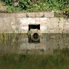
Municipal drainage systems are often out of sight and, unfortunately, out of mind. Yet, these underground networks are vital to public safety, environmental protection, and infrastructure longevity. Accurate mapping of stormwater infrastructure is not only a best practice - it’s an operational necessity.
Whether your municipality is facing new MS4 compliance requirements, planning capital improvements, or simply wants to reduce flooding complaints, having a clear, accurate, and accessible drainage map is the foundation for sound decision-making.
Below is a practical, step-by-step guide on how to map municipal drainage systems effectively.
Start by clarifying your objectives. Are you trying to inventory the entire drainage system or just update existing maps in key areas? Are you targeting public infrastructure only, or also private connections (e.g., parking lot catch basins discharging into the public system)? Determine:
Geographic area (e.g., entire town, urban zones, critical outfalls)
Types of assets (culverts, catch basins, dry wells, manholes, pipes, outfalls)
Required attributes (e.g., diameter, material, condition, installation date)
Many municipalities already have partial drainage maps, albeit outdated or inconsistent. Assemble:
As-built drawings from past construction projects
Highway department sketches and logbooks
GIS shapefiles from engineers or consultants
Historical aerial imagery
State DOT or county records
Digitizing these documents, even if incomplete, provides a valuable starting point.
Mapping drainage systems isn't complete until someone inspects the infrastructure in the field. Equip field crews with GPS-enabled tablets or smartphones to collect:
Location coordinates (preferably sub-meter accuracy)
Photographs of assets
Notes on asset condition or accessibility
Direction of flow (where visible)
Pipe connectivity (e.g., where one catch basin drains to another)
Common tools include Trimble GPS units, ArcGIS Field Maps, Collector for ArcGIS, or more budget-friendly apps like Mappt or QField.
A Geographic Information System (GIS) allows you to create a dynamic, layered map of your drainage infrastructure. GIS software enables municipalities to:
Visualize pipe networks and connections
Store maintenance history and condition data
Overlay aerial imagery, tax parcels, and flood zones
Share maps internally and with consultants
Popular platforms include:
For large municipalities: Esri’s ArcGIS suite or Cartegraph OMS
For small-to-medium towns: Roadwurx, QGIS, or MapGeo
Once your assets are in the GIS system, review them for completeness and accuracy. Key validation steps include:
Checking for gaps or overlapping pipes
Ensuring all inlets and outfalls are connected properly
Reviewing unusual flow patterns or asset placements
Verifying that asset attributes match physical reality
If budget allows, camera inspections (CCTV) of underground pipes can supplement surface-level mapping and reveal hidden issues.
Drainage maps are not a “one and done” project. Treat your drainage system as a living asset inventory. Update it whenever:
New roads or developments are built
Old pipes are replaced or relined
Maintenance crews identify missing or mislabeled assets
Illicit discharges or illegal connections are discovered
Set up a protocol for staff to update the system, ideally through mobile field applications that sync with your central GIS.
Drainage maps can inform planning boards, public works, consultants, and environmental regulators. But they may also contain sensitive data. Ensure your mapping system:
Has access controls for internal use
Can export non-sensitive data to share with the public
Is backed up regularly
Meets data privacy and security standards
Knowing where your drainage infrastructure is, and what condition it's in, is essential for proactive maintenance, emergency response, and environmental compliance. Mapping municipal drainage systems may seem like a daunting task, but with the right tools and workflows, even small towns can build a reliable, actionable inventory.
Whether your community is using advanced GIS or simply starting with field sketches and spreadsheets, the key is to begin. Because when the next storm hits, the last thing you want to say is: “We didn’t know that was there.”
Related Resources:

 Stormwater culverts come in a wide range of materials, and each type carries a unique combination of strength, lifespan, cost, and installation consid…
 A well managed stormwater program depends on accurate and complete information about every outfall in a community. Outfalls are the final discharge po…
 When crews encounter contaminated sediments during routine work, or when a concerned homeowner reports a suspicious odor or unusual discharge, the sit…
 Opening and entering drainage structures requires a practiced, methodical approach that protects workers from unseen dangers and ensures that every st…
 Constructed wetlands are engineered systems that mimic the natural processes of a real wetland in order to treat stormwater, wastewater, or other poll…
 A complete and accurate stormwater map is one of the most important responsibilities for any community that operates as a Municipal Separate Storm Sew…